


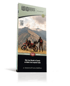
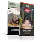


Idaho Backcountry Discovery Route (IDBDR) Map - Idaho BDR Series Map
Third Edition
Couldn't load pickup availability
SPECIAL OFFER – Pair this map with the Idaho Adventure Map and you can save $4. Make your selection in the options above!
If you're craving endless twisty mountain roads, remote wilderness, and epic backcountry riding, the Idaho BDR delivers in spades. Spanning over 1,250 miles of rugged dual-sport terrain, this route is a dream for ADV motorcycle riders looking to get off the grid and into nature. With limited cell service, it's a true digital detox that might just wear out your rear knobby before you reach the end.
The route begins in the historic mining town of Jarbidge, Nevada, and winds through scenic rangelands into the stunning Boise National Forest, offering sweeping views of Andersen Reservoir and prime alpine camping near Trinity Lakes. Along the way, you’ll soak in the rustic charm of Burgdorf Hot Springs, pass through remote mountain towns, and trace the historic footsteps of Lewis and Clark.
Standout highlights include the iconic Magruder Corridor and the rugged Lolo Motorway, which skirt the pristine Selway-Bitterroot Wilderness—one of the largest roadless areas in the lower 48. As you near the finish, you'll ride through Sandpoint and Bonners Ferry, eventually reaching the Canadian border.
Ideal Riding Season: July through October offers the best conditions. Early season rides in late June may be possible if snow has cleared from the high passes. In the fall, expect colder temps, potential early snowfall, and increased hunter activity.
Whether you’re a seasoned adventure rider or planning your first BDR, the Idaho BDR is a must-ride for anyone chasing scenic backroads, historical landmarks, and remote high-country solitude.
- Map Features
- Additional Information
- Highlights a single BDR route | Includes route planning and permit information (when applicable).
- Waterproof / Tear Resistant | The road can be tough on your gear. Our maps are designed to withstand abuse.
- Packs Easily | This map folds to 4.25” x 9”.
- Detailed Information | Includes written descriptions, section breakdowns with mileage, and elevation profiles.
| Weight | .22 lbs |
| Dimensions | 9 × 6 × .25 in |