
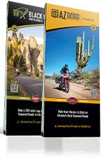

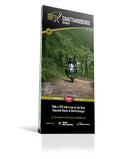
Chattahoochee, Georgia - Chattahoochee BDR-X Map
First Edition
Couldn't load pickup availability
NOTE: This map, along with all the BDR-X maps, are produced solely by the BDR. While Butler Maps supplies all cartographic information, the design and printing are handled by them.
This 350-mile adventure loop showcases the best dual-sport and ADV riding in North Georgia’s mountains. Winding through the Chattahoochee National Forest, the route blends graded forest roads, rugged two-track, and scenic backcountry pavement beneath a dense canopy.
Along the way, riders pass through charming mountain towns like Ellijay, Dahlonega, Suches, and Helen, with plenty of lodging and camping options. The route crosses the Appalachian Trail, features challenging climbs, twisty asphalt, and multiple creek crossings, delivering a true Southern backcountry experience. Unlike many northern routes, the Chattahoochee BDR-X is rideable most of the year, with the best conditions from March through December, depending on weather and seasonal road closures.
The official BDR-X map includes detailed inset boxes highlighting key route amenities such as on-route and nearby gas stations, lodging (including campgrounds), food and markets for provisions, town and pass elevations, trailheads, and scenic overlooks—plus a master elevation profile for planning. Every BDR-X map is printed on "Trail Tough" HopSyn waterproof, tear-resistant paper, built to withstand the toughest conditions.