


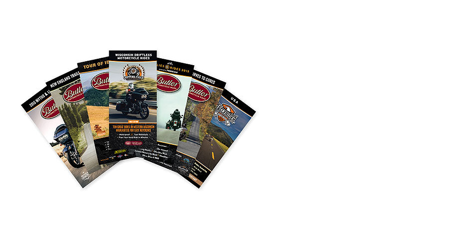


Canadian Border Map Collection
Couldn't load pickup availability
Explore the Edge of the Continent with the Ultimate Northern Road Trip Collection
The Canadian Border Collection by Butler Maps is a 5-map G1-Series bundle designed for those who live for epic road trips, twisty blacktop, dual-sport detours, and remote landscapes that still feel wild and undiscovered. Spanning from Washington to Maine, this collection is your key to exploring the northern tier of the U.S., where rugged terrain, cultural richness, and world-class riding collide.
Every map in the collection is printed on waterproof, tear-resistant HopSyn synthetic paper, designed to endure tank bags, tail bags, and trail dust. All routes are rated using Butler Maps’ patented road rating system, highlighting the most scenic paved roads (Gold, Red, and Orange) alongside 40+ recommended dual-sport dirt roads on each title.
Whether you're riding the spine of the Cascades, tracing river valleys along the Mississippi, or climbing toward the Cabot Trail, this collection takes you beyond the expected—into the best paved and dual-sport roads near the Canadian border.
What’s Inside:
Washington G1-Series Map
Welcome to the Evergreen State—where volcanic peaks, dense forests, and backroad bliss await. This map covers icons like the North Cascades Highway, Mt. Baker Scenic Highway, and Chinook Pass, but also unearths lesser-known treasures such as Hurricane Mountain Road, Wind River Road, and the quiet curves of Tonasket–Havillah Road. Forty-eight inset maps showcase top riding areas, and dual-sport options like Forest Roads 25 and 99 offer seamless transitions from pavement to dirt.
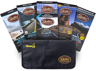
Idaho G1-Series Map
Idaho delivers high drama and remote solitude, with over 17 epic paved routes including Lolo Pass, St. Joe River Road, Old Whitebird Grade, and Winchester Grade. You’ll ride through tight canyons, over wide mountain passes, and past glacial rivers and hot springs. The map also highlights all dirt thoroughfares, trailheads, scenic overlooks, and campgrounds, making it a complete tool for both paved and dual-sport adventure.
Montana G1-Series Map
Big Sky Country offers expansive views, hidden gems, and legendary byways. You’ll find Beartooth Pass Scenic Byway, Going-to-the-Sun Road, and Lake Koocanusa Scenic Byway, along with remote roads like Yaak Valley, Looking Glass Hill Road, and Wolf Creek. Seven inset maps highlight the best of Montana’s northwestern wilderness, with added dual-sport options scattered throughout the Kootenai and Flathead National Forests.
Wisconsin / Michigan Upper Peninsula G1-Series Map
Ride deep into the Midwest’s forgotten curves. The Driftless Area of Wisconsin offers jagged terrain, limestone cliffs, and winding roads following the Mississippi and St. Croix Rivers. In Michigan’s Upper Peninsula, ride into the Keweenaw Peninsula, explore Wildcat Mountain, and cruise through the Kettle Moraine. Inset boxes include scenic overlooks, fuel stops, trailheads, and over 40 dirt road recommendations for dual-sport and ADV riders.
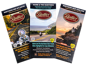
Maine & The Maritimes G1-Series Map
Explore the far northeastern reaches of the continent with a map that covers Maine, New Hampshire, and the Canadian Maritimes. Beyond the famous Mt. Washington Auto Road, discover the Gaspe Peninsula, Cabot Trail, St. Lawrence River Region, and Prince Edward Island. This map is the product of 39,000 miles of on-the-ground riding, digging deep into local knowledge to bring you everything from twisty scenic highways to remote dual-sport loops through thick forests and along the Atlantic coast.
Why Choose the Canadian Border Collection?
Designed for motorcycle travelers, but equally useful to overlanders, road trippers, and vehicle-based adventurers
Showcases the most scenic paved roads and hand-selected dual-sport routes near the U.S.–Canada border
Includes hundreds of points of interest, campgrounds, national parks, fuel stops, and photo-worthy overlooks
Built to endure—each map is printed on waterproof, tear-resistant synthetic paper
Whether you're planning a full-blown coast-to-coast ride, stringing together long weekends, or dreaming up your next borderland expedition, the Canadian Border Collection gives you the tools to go farther, ride better, and discover more.