


Rimrocker Loop Trail in Colorado & Utah - Adventure Loop Series Map
First Edition
Couldn't load pickup availability
**WILL SHIP MID JULY. ALL MAPS IN ORDER SHIP TOGETHER.**
--
**Rimrocker Trail: The Complete Loop**
The Rimrocker Trail is an iconic Western Colorado route connecting the high desert plateaus of Montrose to the red rock mecca of Moab, Utah. While there's no shortage of information out there, Butler Maps has done the hard work of cutting through the noise — pulling out only the most mission-critical points of interest, the best places to stop, and the experiences worth your time on this trail.
Then we closed the loop.
The return route climbs through the dramatic La Sal Mountains outside of Moab before descending through John Brown Canyon, linking up with Colorado 141 — threading the needle through Gateway's towering red rock walls along the Dolores River corridor — then climbing south onto the Uncompahgre Divide Road for high-ridge running with sweeping views before delivering you back to Montrose. Two legs. Zero repeated miles. One complete loop.
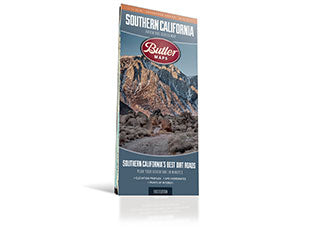
This waterproof, tear-resistant half-sheet map covers the full circuit with expanded callout boxes highlighting the best stops, overlooks, fuel points, and can't-miss highlights along both legs. Built for adventure motorcyclists and overlanders who want to navigate with confidence on paper — and backed by a free GPX track download at butlermaps.com.
$14.95 | Half-Sheet | Waterproof & Tear-Resistant | Free GPX Download
- Map Features
- Additional Information
- Highlights The Best Dirt Roads | Features off-highway specific information such as terrain iconography and riding permit requirements
- Waterproof / Tear Resistant | The road can be tough on your gear. Our maps are designed to withstand abuse.
- Packs Easily | This map folds to 4.25” x 9”.
- Detailed Information | Includes written descriptions, points of interest, terrain icons, and elevation profiles of the best dirt roads.
| Weight | .22 lbs |
| Dimensions | 9 × 6 × .25 in |