


Northern California and Southern California G1 Series Map Bundle
Couldn't load pickup availability
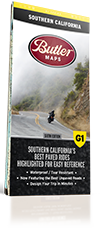
The Golden State has a land area of over 156,000 square miles. That’s a big piece of land! So big as a matter of fact, that we had to break it up into two separate G1-Series maps. Southern and south central California, which covers all the best rides up to Bishop in the east and Watsonville in the west and northern California which showcases these amazing roads from there up to the Oregon border. The Butler Maps team rode over 95,000 miles in the course of three years to bring this collection to fruition. We’ve included thousands of miles of the most dramatic sections of paved and dirt roads highlighted in Butler Maps popular Gold, Red and Orange colors and are accompanied by crucial information about places to eat, sleep, fuel up and cool down. You will also find detailed inset boxes showcasing a complete list of campgrounds, town/pass elevations, trailheads, parking lots, scenic overlooks, interpretive trails, contour intervals, secondary/tertiary roads as well as all dirt thoroughfare options through California’s unbelievable landscape.
Every Butler Maps G1 Series map is printed on “Trail Tough" waterproof, tear-resistant paper called HopSyn. A full alpha-numeric grid is printed on each map to aid with navigation and orientation. All of our G1-Series paved road maps also feature over 40 recommended dual-sport roads so you can opt from the best paved sections of road to the best dirt sections of road simply by following the colors and icons. Find the best riding, with the most scenic views, packed full of drama and peril in this G1-Series NorCal / SoCal G1-Series map bundle!